
MODULE 2 - SCOUTING FOR ELK
CHAPTER 1: RESOURCES FOR SCOUTING

Regardless of the topic or context, nearly everyone nowadays turns to the Internet to answer any questions that they might have. The fact that you’re reading this right now supports that. When you want to learn about any topic, you no longer go to the library or open an Encyclopedia. Instead, you pull out your phone, crack open your laptop, or fire up some other “connected” device. You can take this same digital approach for scouting an elk hunting area too.
INTERNET “SEARCH” INFORMATION
Before you start searching for information on your elk hunting area through Google, be sure to visit the direct source and reference the Game and Fish website for the state you intend to hunt. The links for many of those websites can be found in Module 1. Often times, you can find very valuable information that is specific to the unit or area of the state you are planning to hunt. When it comes to making broader web searches, use search keywords that will lead you to exactly what you are looking for. Instead of searching for “elk in Wyoming” – which will return a ton of information, much of which won’t be valuable to you – search for more specific information about the area you are going to be hunting. Search for “Wyoming elk unit 98” if that is where you plan to hunt. You can even get weapon-specific and search for “Wyoming archery elk unit 98”.
Additionally, instead of using the unit number, you can also get area-specific intel by using geographic or topographic features that are notable in that area — named peaks or passes, forest names, trails and trailheads, named waterways, etc. For example, if you are looking at maps and notice that Sherman Pass is a place in the unit you are considering for your Wyoming elk hunt, then search for “elk hunting Sherman Pass Wyoming” and see if there are any helpful results. Even a generic search for “Sherman Pass Wyoming” can yield a ton of information related to the area; trails, roads, even images of the actual area.
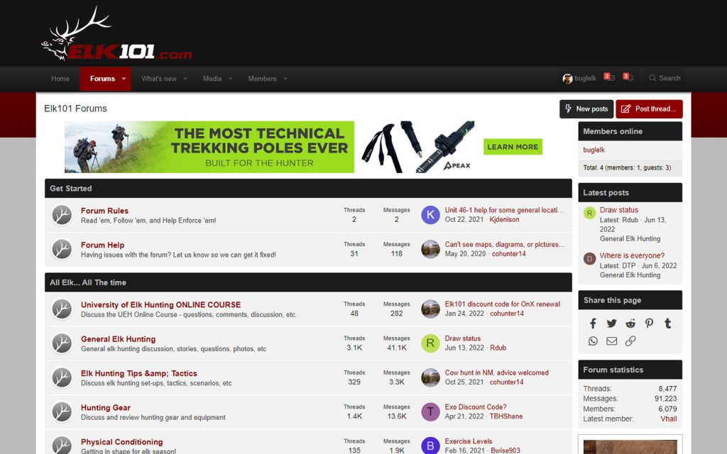
If you are searching for elk hunting information for a particular area, you will often find that some of the best results can come from elk hunting forums. There are dozens of hunting forums on the web, and many of them contain helpful posts. If you are lucky, you will find some posts referencing the specific areas you are researching, and forums can be a great place to ask questions as well. A few of my favorite hunting-related forums are listed below:
https://forums.elk101.com/
http://onyourownadventures.com/hunttalk/
http://forums.bowsite.com/tf/bgforums/
https://www.rokslide.com/forums/
LOCAL RESOURCES
The Internet might be the first place that most people look for information, but it’s not always the best location to find information. What if there was someone that had first-hand experience in the exact area you are scouting? What if there was someone who knew the area so well that they had a solid grasp of the terrain, the elk habitat, the access, the hunting pressure, and the finer details about the elk population (age class, bull-to-cow ratio, etc.)? What if you could talk to that person? Maybe you can. It might take a little digging, but you can usually get the contact information for wildlife biologists or game management officials that are responsible for the area you are scouting. These individuals make their living by understanding and managing the game you want to hunt, and they can be a fantastic resource. Make a phone call to the main wildlife management office in the state you are planning to hunt, and ask them to connect you to the office or person (wildlife biologist, game management official, field officer, etc.) that is responsible for the area you are interested in. When speaking to one of these individuals, it is imperative that you are prepared with specific questions about specific areas you want to know more about. These folks often get bombarded with generic questions about a unit or area, so the more prepared you are to tap into their knowledge, the more information you will probably be able to extract from them. If you can demonstrate that you have done your homework and are looking to add to it, they will often times be much more willing to give you some true nuggets of information. Calling one of these individuals and asking them, “Where would you suggest I go to hunt elk?” is going to get you a very canned and oft-repeated answer. Do some homework ahead of time and give them some specific scenarios and questions that they can speak to. Your call should include details, such as: “I am thinking about hunting near Sherman Pass during the early archery season and will be making my approach from the Maystone trail. At what elevation have you seen the most rutting activity in that area during that time?” Or, “Is Maystone trail heavily trafficked during the first half of September?” Demonstrate that you have already tapped into all the available information on the area, and you’re looking for more detailed, current info. “The statistics for the previous year’s hunts are trending in a positive direction — is the herd still healthy after this winter and do you feel this will be another good year for this area?” Everyone wants good information, but many hunters don’t spend enough time thinking about the specific information they need. Put some effort into your research and preparation, and you will get value out of the information you receive.MAPPING RESOURCES
If you want to understand elk country, you need to know how to look at it. First, you need to have a map. Secondly, you need to understand what you are looking AT on that map. Lastly, you need to know what you are looking FOR on that map.TOPOGRAPHIC MAPS
The most helpful type of map for outdoor pursuits is also the most common type of map, and that is a topographic map. A topographic map presents a three-dimensional landscape on a two-dimensional surface. We can’t see height and depth on paper or on a screen, but a topographic map can give us a representation of height and depth via “contours.”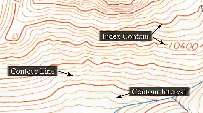
A contour is a line that connects points of equal elevation. So, if you walked along any contour line on a topographic map, you would remain at the same elevation the entire time. However, if you begin to cross over contour lines, you are either gaining or losing elevation.
Every fifth contour line on a topographic map is an index contour – which is a visibly thicker line with a marked elevation. It is important to look at the elevation scale of the map, which can be determined by observing the change in elevation between index contours. On many topographic maps, the change in elevation between any two index contours is 200′ (which would mean the elevation change between each contour line would be 40′).
Finally, the spacing between contour lines determines how steep or gradual the change in elevation is in that area. For example, in the map image above, there are large contour intervals at the bottom of the map, compared to the very small contour intervals at the top-center of the map. The area at the top of the map has a much steeper incline (the contour lines are very close together), and the area at the bottom of the map has a relatively flatter surface (the contour lines are spaced further apart).
IDENTIFYING TERRAIN FEATURES
Topographic maps excel at representing the 3D height and depth of terrain — the elevation changes that form ridgelines, saddles, ridges, valleys, and other features. Topographic maps can also be helpful for identifying other aspects of an area, such as water sources (lakes, ponds, rivers, creeks, springs, and streams), roads, trails, and named terrain peaks, passes, canyons, valleys, etc. Clearly, water sources, roads, and trails all play a huge role in elk hunting. And the specific (named) terrain features in an area can help you refine your research of the area, as I mentioned above. Understanding what certain terrain features are, as well as how they can affect your hunt, will be incredibly valuable when I talk about elk habitat in the coming chapters. Here are a few features that you will encounter in elk country:
#1 – Saddle – A low point between two areas of higher ground. A saddle is most easily identified as a low spot between two hilltops or peaks, but a saddle can also be simply a dip in a ridgeline. If you are in a saddle, you have high ground in two opposing directions and low ground in the other two directions. A saddle can often be identified by contour lines that form an hourglass shape.
#2 – Ridge – A long line of sloping ground, with higher elevation in only one direction. If you are standing on a ridge, you have low ground falling off two opposing sides, and a high/low line running the other two directions.
A ridgeline is a primary line of high ground, often connecting peaks or hilltops, from which other terrain features originate. For example, a prominent ridgeline can be seen as you move left from Point #6, towards Point #1, and then the ridgeline splits at a “Y”, towards Spruce Mountain and Davis Mountain. (The ridgeline actually begins far above point #6, outside of this map’s view).
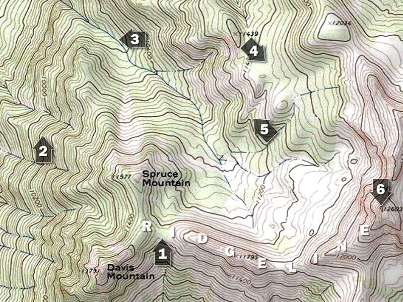
#3 – Valley – A long stretch of low lands, commonly formed by waterways, in which three directions have higher ground and one direction has lower ground. Usually two opposing inclines are very apparent, while the opposing high/low line (the valley “floor”) may be less distinguished; look for the direction of water flow to determine the high/low direction of the valley floor.
#4 – Bench – A bench isn’t a primary or formal topographical feature, although it is very commonly referenced in hunting. A bench is a flat (or at least comparatively flat) area that exists on the rise of a ridge. A ridge will climb and climb, flatten out to a bench temporarily, and then will continue to climb to the ridge peak. Benches are often found mid-way up a ridge side.
#5 – Draw – A draw or “cut” is similar to a valley, but a valley is typically long and parallel to a ridgeline, whereas a draw is commonly smaller, steeper, and usually perpendicular to the ridge. A draw is commonly created by water flow or rockfall. A draw is identified by “U” or “V-shaped” cuts perpendicular to a ridge, where the narrow portion of the U/V is pointing to higher elevations.
#5 – Spur – A spur is the opposite of a draw, in that a spur is typically the high ground that is left between two draws or cuts. A spur features “U” or “V” shaped contours where the narrow portion of U/V shape point to lower elevations.
#6 – Hilltop or Peak – A hilltop or peak is an area of high ground where the surrounding ground loses elevation in all directions. Hilltops and peaks can be easily identified on topographic maps by looking for contour lines that form complete, concentric circles.
WHERE TO FIND TOPOGRAPHIC MAPS
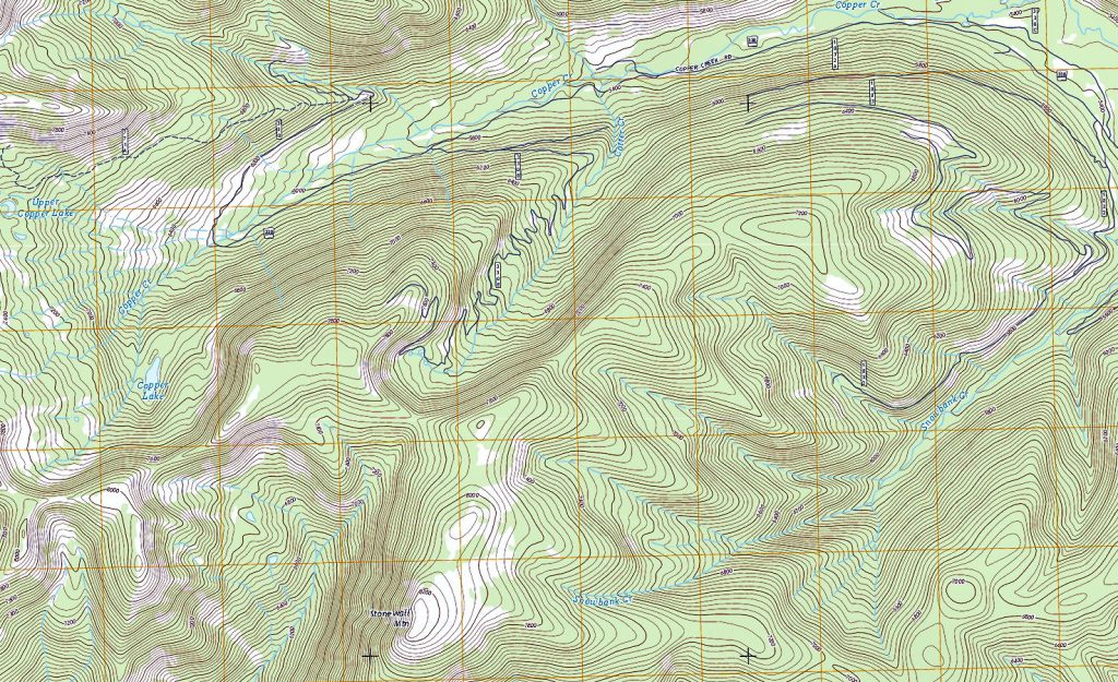
There are dozens of places to find topographic maps online, but I will mention a few that you should definitely know about. First and foremost, understand that “official” topographic maps are created, managed, and distributed by the United State Geological Survey (USGS). At the USGS Website, you can browse and purchase the most up-to-date official topographic maps.
There are numerous other online tools that allow you to interactively explore topographic maps and offer additional tools such as measuring, marking and saving points, swapping between different versions of base maps, etc. A few of the free online topo map websites you might check out are: CalTopo, ACME Mapper, and ArcGIS.
If you want a printed topographic map to carry in the field with you, MyTopo.com provides a service that allows you to create a custom, just-for-you, map according to the specific size, zoom level, and coverage area you want. You can also include hunting unit boundaries and much more.
THE POWER OF ONX
Perhaps the most powerful resource for mapping that I personally use is a “HUNT Membership” at OnXMaps. A HUNT Membership to OnX will provide you with access to Topo and Aerial Maps on both your computer and your mobile device. And it includes way more than just the Maps.
With OnX, you can overlay multiple layers onto the maps of your area. Some powerful layers that I find handy include Private Land boundaries, Hunting Unit boundaries, Roadless Areas, Timber Cuts, Historic and Current Wildfires and much, much more! This resource truly puts all of the information you could ever want or need all in one location, and allows you to access it from both a computer and a mobile device.
One of the coolest aspects of this Membership is the ability to research all of this information from your computer in conjunction with other resources like Google Earth, and then identify and save waypoints such as trails, wallows, north-facing slopes, and other key elk habitat features.
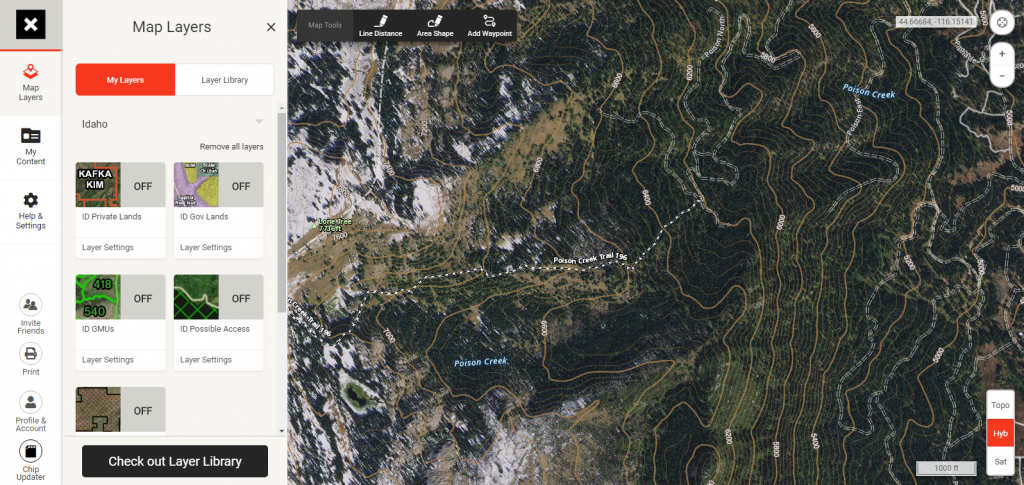
Then, with these features saved, when you open the app on your mobile device, everything automatically transfers over and is accessible between devices. You now have all of that power at the tip of your fingers…at home AND in the field. And the OnX app allows you to easily download selected maps of your hunting area directly within the app, so you are able to access all of this information without WiFi or cell service when you are in the field!
FIRE MAPS
Elk hunting in the west brings with it a full spectrum of unknowns. In fact, I’ve dedicated an entire Module in this Course just to Common Challenges associated with elk hunting. In Module 11, I will discuss the potential frustrations that can come with forest fires, but since we are talking about mapping resources in this Module, I want to include mapping resources here that can be helpful in keeping up to date on fire activity. Additionally, these resources can provide information about past fire activity, and alert you to the possibility of finding heavily burned areas that other maps don’t show. For current forest fire activity: http://inciweb.nwcg.gov/ or https://fsapps.nwcg.gov/afm/ . A GREAT resource for monitoring current fires, as well as seeing the perimeters and burned areas from previous fires is available through the NIFC (National Interagency Fire Center): NIFC Fire Perimeter Data As you can see, there are a lot of resources available at your fingertips to help you acquire information that will establish a strong foundation for a successful elk hunt. I definitely utilize all of these resources to some level in all of my hunt planning and scouting, but I feel that the most powerful scouting resource I have access to once I have gathered this information, is Google Earth.
Click 'Next Chapter' Below to learn how to use Google Earth to scout for elk!


